Nathalie Deguen, Sales Manager at PARIFEX, details the ways in which smarter traffic management technology can improve key decision making, and bolster city infrastructure, transport services and liveability.
How important is data to modern traffic management and how can it be utilised and analysed to aid city decision makers?
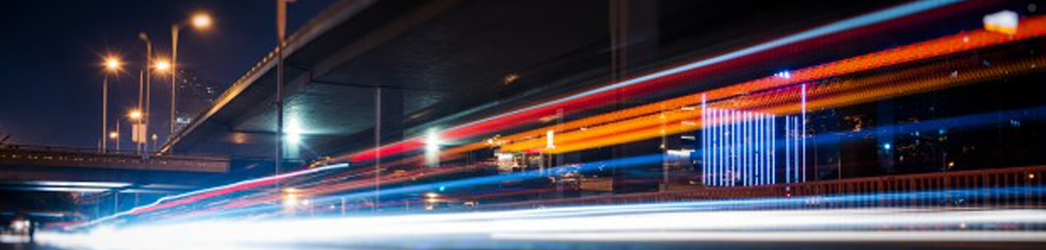
Using data is obviously essential in traffic management because cities want to understand what causes traffic congestion and how they can improve mobility by understanding traffic flow, and understanding the habits and behaviours of drivers. Cities want to see if their infrastructure is adequate, whether their signal timing is adequate.
The challenge of mobility is complex, but the solution to a city’s problem could be as simple as an intelligent intersection. For something like this, it’s very important to not only analyse the data but to have valuable data. Counting is the first step, but being able to classify the vehicles – distinguishing a pedestrian from a cyclist and a cyclist from a motorbike, for example – offers city authorities much more valuable information. If a city were to use smart sensors to detect vehicle traffic and adjust signals in real time, it could significantly reduce travel times, wait times and vehicle emissions.
There are a lot of ways to collect traffic data now, but the difficulty is collecting precise, efficient data while complying with GDPR. Cities need very precise data in real time – they want to know exactly what’s happening, where and how.
That’s the next stage in achieving what PARIFEX calls advanced traffic management. Cities want real-time traffic data from cameras, speed sensors and other technologies to flow into a transportation management centre, be processed and then weigh up potential actions based on the outcome of the analysis. That’s the main difference between real-time traffic analytics and analysis that is instead based on historical data.
Taking the example of traffic signals, advanced traffic management could adjust traffic signals based on real‑time traffic conditions. That traffic data could then be sent to connected vehicles in the traffic, enable inter-agency data sharing, and have all of that data fed into public transport platforms to enable cities to better manage their mobility ecosystem.
How can traffic management technology help to support cities achieve their wider policy goals – for example, reducing congestion to help fight climate change?
Congestion results in many challenges for cities. You’ve mentioned the environment, but there’s also citizen comfort, traffic accidents and a number of other safety aspects to consider, too. Better traffic management technology is the key to having a better and more up-to-date picture of what’s happening and what actions need to be taken.
It can help cities to adapt their existing infrastructure – perhaps a road needs extra reserve lanes, or an extra lane for cyclists. Technology can help city authorities make these decisions. It can also help cities to provide rerouting options in case of traffic jams, and in real time help drivers gain access to accurate route conditions.
This kind of technology also delivers better traffic safety and control – for example, adapting traffic light timing for better traffic flow. So much is then linked with traffic light timing – it could also result in reducing gas emissions as cars would be idle for a shorter amount of time.
How are today’s traffic management technologies helping prepare the foundation for tomorrow’s mobility?
Using these technologies helps cities to have better picture of what’s happening on the roads and adapt to offer new mobility solutions. Smarter mobility could include the introduction of autonomous vehicles, for instance, or maybe to implement more solutions for cyclists. Every city’s aim is to reduce the concentration of vehicles.
In our current situation with COVID-19, people are doing things differently – for instance, changing the way they get to work by using a bike. In response, cities are installing more bike-specific infrastructure, but they need to know whether taking that action is safe, whether the solution they’re putting in place is adequate and that the placement of the adapted infrastructure isn’t going to cause an accident. It’s absolutely essential for authorities to use every tool at their disposal to understand their situation before taking action.
Where is PARIFEX working currently and how are you helping cities and road authorities to overcome some of these issues?
PARIFEX has developed a new solution based on 3D-Lidar, which is a very precise and powerful technology frequently used in mapping. The data collected by Lidar sensors can be used for many applications. That is why PARIFEX designed this sensor to be able to detect any moving target in its field of vision. For each target, the sensor receives very precise information, such as its position, its direction of travel, its speed, and its dimensions – from which it can detect the category of the vehicle. All of this is done in real time.
The advantage this technology has over something like a smart camera is that the Lidar sensor works exactly the same way in all light conditions, including its response time and the quality of data it produces. PARIFEX has developed the technology for use in a traffic counting solution, so it can detect and classify all objects in real time.
PARIFEX has been selected by the Ministry of Ecology in France for an innovation project using the solution, which will be piloted in the first quarter of 2021. We’re really convinced by the solution’s potential and the potential project outcomes, and I think it’s going to be very interesting for cities to see the possibilities they have when using systems like this to better understand their traffic.
Contact us
Fields marked with * are required.